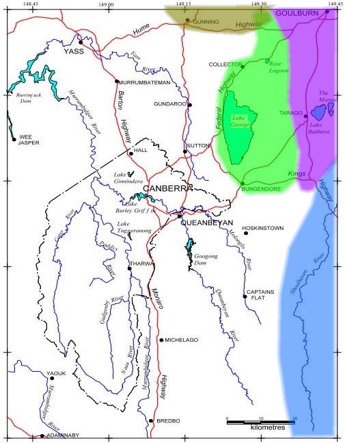
Returning to the matter of the Rose Lagoon catchment, it does seem that it and Wollogorang Lagoon lie within a basin where the waters are locally contained, the main repository being Lake George although the smaller ones are independent
of it, separated by divides of only a few metres height. Wollogorang Creek passes by the lagoon of that name and meanders north of the Hume Highway, just failing to reach the depression
that is the start of the Lachlan (olive shading). Superimposing the approximate catchment boundaries on the AOI map gives quite a complex picture, surely one of the more interesting AOIs, hydrologically speaking, of any national capital. No doubt others
will know more detail. For example Lake Bathurst is possibly self-contained, while the nearby ‘The Morass’ feeds into the Mulwaree/Wollondilly (violet shading), which used to reach the Hawkesbury before being contained by Warragamba Dam.
And to where does Whiskers Creek flow? The white area is the Murrumbidgee catchment.
Between Canberra and Braidwood, the Kings Highway passes through 4 catchment areas. Corrections happily received.


