My reason for returning to this subject is that I have a few new things to say. The first is to confess my incompetence in making use of Google Earth. Children these days probably learn about this kind of thing in first
grade. I knew that the imagery was captured at different dates, but I had not realised that in the composite imagery what is shown for a particular location may not be the latest available. For JWNR, the capture date in the composite imagery is April 2019.
However, if you go to the ’Historical imagery’ and select the latest available capture you can, for that location, obtain the view for March 2022. This is well into our continuing La Nina period, and the view shows for practical purposes the waterlogged
scene at the present time. (As a gumbooted Alastair was telling me yesterday, much of the area is not able to be walked over for bird survey purposes.)
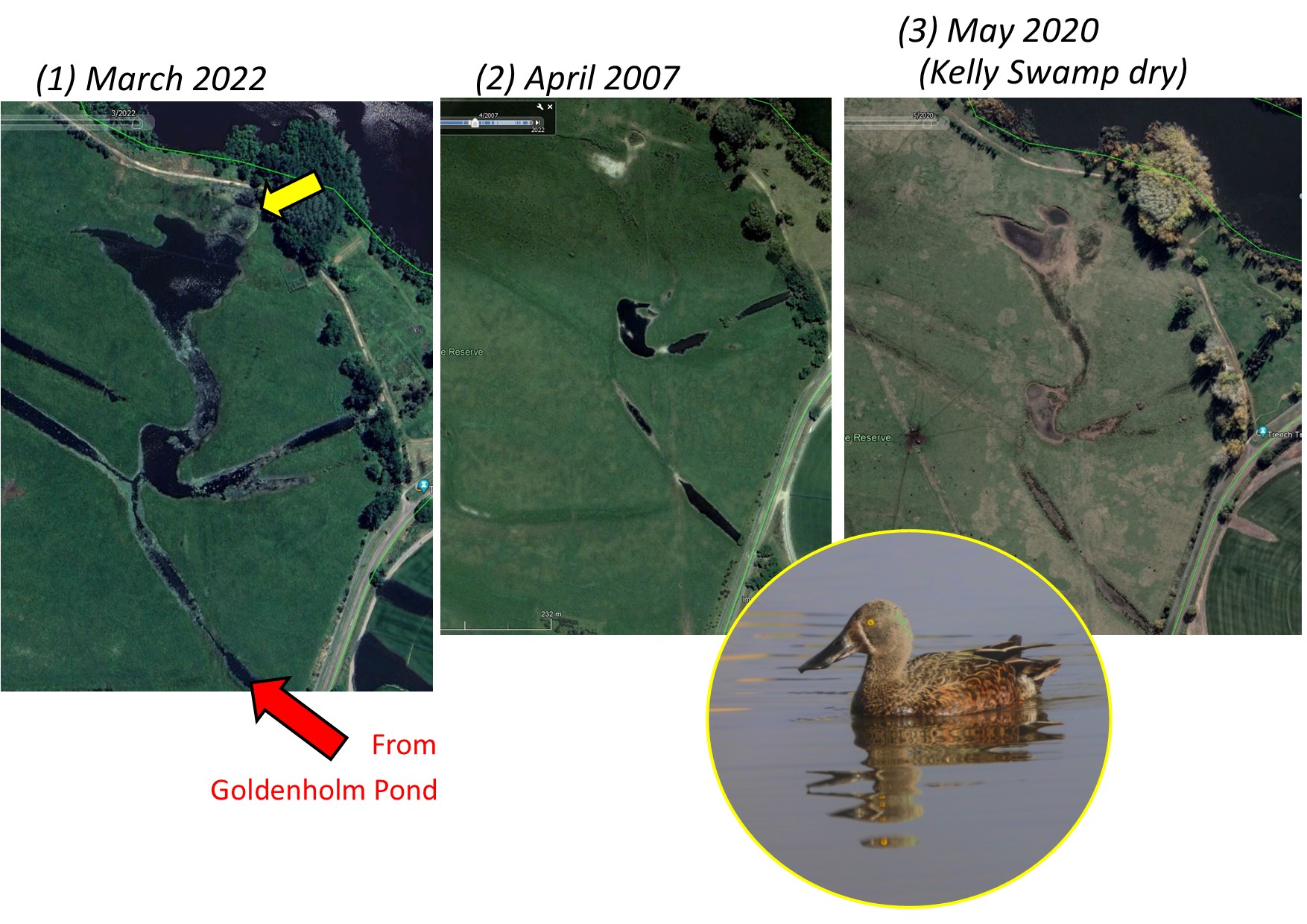
In (1) below the long flood channel shown by the red arrow feeds into the Shoveler Pool complex. The yellow arrow shows where shallow flooding has reached the fence, making it difficult to explore further on foot. The
northern part of the complex, having been excavated at some time, is a little deeper than the southern, generally retaining water for longer in dry periods. However in the 2007 picture (2) more water is found in the southern section than has found its way
to the depression further north. In May 2020, when Kelly Swamp had dried, the relevant features of the drying floodplain are obvious. The depressions consist of drying mud. Tracks of cattle moving to feeding stations are evident.
All this talk of shovelers justifies inclusion of the drake which was commuting around the area yesterday morning.
From: Canberrabirds <>
On Behalf Of Geoffrey Dabb
Sent: Thursday, 8 September 2022 2:01 PM
To: 'Canberrabirds' <>
Subject: [Canberrabirds] Not so much a palaeochannel as ...
There is nothing like having a look for yourself. Yesterday I did some walking on the margins of the floodplain. The photo at left below shows the red channel as it emerges from under Dairy Road
and pursues a course north-west to the Shoveler Pool complex, with which it has probably merged. There is water everywhere. Below is a view of the present extent of Shoveler Pool which has a few birds making use of it, although no actual shovelers that I
could see. A deceased Barn Owl was lying by the multi-user pathway alongside Dairy Road.
From: Canberrabirds <>
On Behalf Of Geoffrey Dabb
Sent: Saturday, 3 September 2022 3:54 PM
To: Canberrabirds <>
Subject: [Canberrabirds] FW: While we are on the subject of wetlands
Thank you all for your interest in this matter. I have since looked into the mapping in the 2013 Butz report and the 2014 JWNR ‘Concept Plan’. This confirms the existence of the channel I have
indicated (called here for convenience ‘the red channel’). However, I should make the following corrections/clarifications.
The pool at ‘C’ has a name, ‘Goldenholm Pond’, being the name of a former dairy that was located at the present turf farm offices. The pool near ‘D’ is part of an old channel, but the name ‘Shoveler
Pool’ is usually applied to the pool (sometimes connected) shown further to the north. (See Concept Plan.)
The north-south channel that enters Jerra Creek at ‘F’ is of human construction and is known as the Causeway Channel.
There is an unresolved question how the red channel, and similar channels, should be described. According to an authority cited in the Butz report, the red channel is an ‘active flood channel’,
the term ‘palaeo channel’ being applied to features of a greater age, Jerrabomberra Billabong being an example. However, the Butz report uses ‘palaeochannel’ for what might otherwise be called existing ‘flood channels’ (see Table 11). The red channel is
designated Palaeochannel 8 and 14 at different points. The Concept Plan reserves the term ‘Palaeochannels’ for the shallow gullies to the west of the vehicle track that are now flooded to variable levels depending on the level of Lake Burley Griffin. This
does not seem to me to fit the dictionary definition of ‘palaeochannel’ but I am sure there will be experts out there who will know more about this.