A reduced resend – earlier message too large evidently.
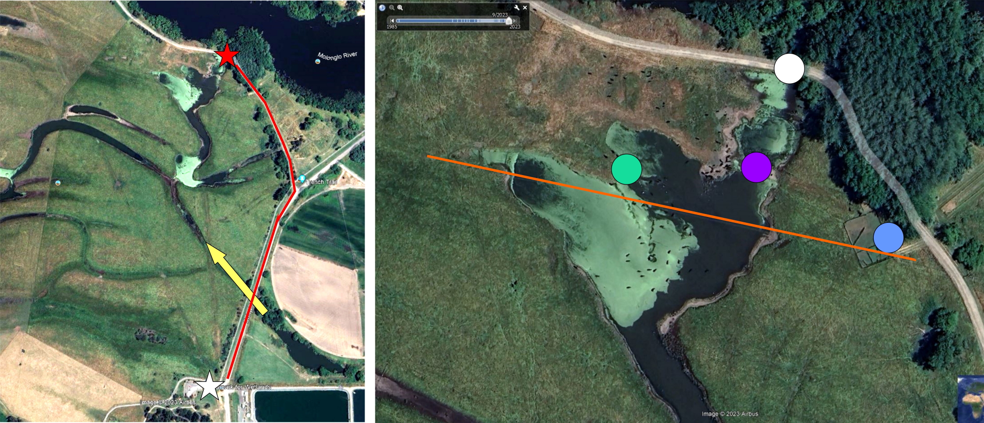
After a prompt or two, I attach directions to Shoveler Pool. The red line is route from car park (white star), about 1km one way. This Google Earth image shows state of water as of this month. Yellow arrow is where
channel from Goldenholm Pond passes under old Dairy Road. Shown on right is the northern section of the Shoveler Pond complex. White disc, step-through gate on vehicle track; blue disc, cattle loading enclosure; violet disc, earthwork, old track – shallow
water north of this; teal disc – ‘Teal Point’. Power line, in orange, is a useful reference point for locations. This is a wetland where, given lack of screening cover, lingering humans even on the vehicle track can enliven resting waterfowl. They tend
to move to far side. This afternoon there was nothing unusual, but while standing in one spot I had in view – 129 Grey Teal, 67 coots, 5 Black Duck, 4 Hardhead, 2 Chestnut Teal, 2 shovelers, 3 wood duck.