Thank you for a range of suggestions. This has brought out that a number of such projects are on foot around Canberra in the name of improving water quality. In general I think these have turned out to be successful improvements of degraded
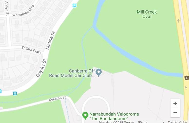
spaces. Shorty certainly has his finger on this area. It might be described as Jerrabomberra Creek flats between Monaro Highway and Canberra Avenue, Here is a street map with part of Lower Narrabundah on the left. ‘ Mill Creek’ was evidently the name
of the small streamlet that joins Jerrabomberra Creek at the bend. There used to be a sign ‘ Mill Creek Park’. Years ago I did a survey here for a blitz week-end. Nothing of great interest: reed-warblers, blackbirds, silvereyes. Anyway, this will let
you know where the Canberra Off Road Model Car Club can be found. ‘Mill Creek Oval’ is shown in the wrong place.

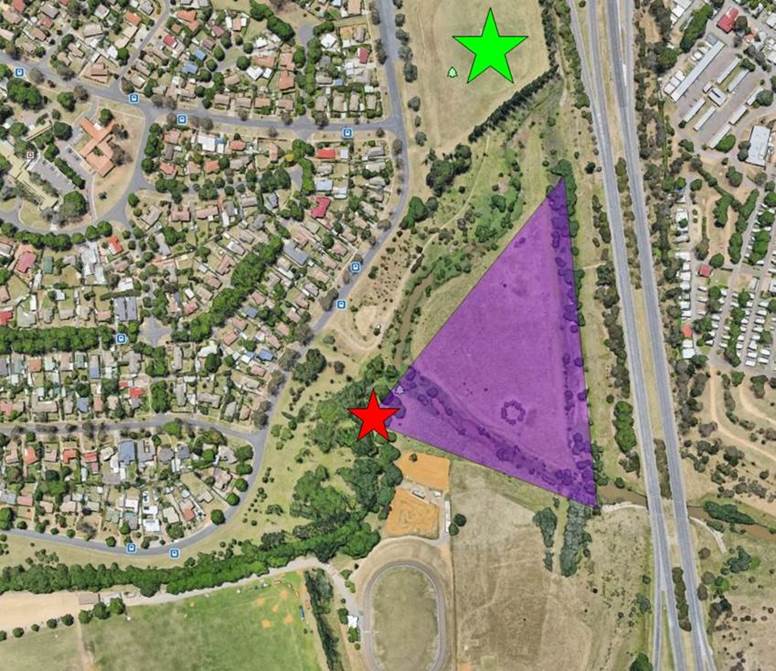
In the below fragment from Google Earth, the green star marks Mill Creek ‘oval’, which extends north nearly to where Jerrabomberra Creek flows under Canberra Ave. The red star was the vantage point for my photo which covered roughly the
purple triangle. A name will be needed for the new wetland. Hang on a minute. What about ‘ Jerrabomberra Wetlands’?


